

Westerham, Kent · TN16
Ricketts Hill Road, Tatsfield
Ricketts Hill Road, Tatsfield, Westerham, Kent, TN16
79 of an acre. **Key facts** - Council tax band: G.
The home, in the agent’s words
Read the full agent description
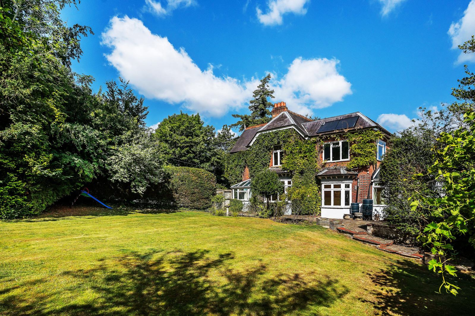
\*\* CHAIN FREE \*\* A substantial and imposing Victorian family home with generously proportioned accommodation set in a semi rural location Reception Hall, Sitting Room, Dining Room, Study, Family Room, Conservatory, Kitchen/Breakfast Room, Utility & Downstairs Cloakroom, Office, Main Bedroom with En Suite Bathroom, 3 Further Bedrooms & Family Bathroom, In & Out Driveway with Plentiful Parking, Established Gardens, Entire Plot extending to about 0.79 of an acre. **Key facts** - Council tax band: G. - EPC rating: D \(score 55; potential rating D\). - Parking: off street, garage. - Outside: garden.
What it's like to live in
The practical details that shape daily life here, each with its source. Anything the listing leaves open becomes a question to ask.
Garage + Driveway
- Parking: off street, garage.
Agent's descriptionGarden
Agent's descriptionUp to 1,000 Mbps
Available to 67% of premises in the postcode (Ofcom, Jan 2026). Postcode coverage, not a speed guarantee: check this exact address with a provider.
Ofcom postcode coverageFreehold
Supplied listing field and any agent featuresBand G
Council tax, Band G
Agent's descriptionRated D. Check the assessment date on the certificate.
Agent's descriptionQuestions worth asking
The listing doesn't answer these. Tick any you'd like to ask and they'll be added to your enquiry message.
Nothing added yet
Loading room styling…
Life nearby
A feel for the area
Getting about
3.5 milesto Oxted Rail Station
Approximate straight-line distance · DfT NaPTAN · 13 Sept 2026Background air quality
- Fine particles · PM₂.₅
- 7.0 µg/m³ · Above the WHO guideline · well within the UK legal limit
- Nitrogen dioxide · NO₂
- 8.1 µg/m³ · Meets the WHO guideline
Annual background levels. For scale: the WHO 2021 guideline is 5 µg/m³ for PM₂.₅ and 10 for NO₂; the UK legal limit is 20 and 40. Lower is better; this is a 1 km model, not a reading at the door.
Defra · 2024 annual model · 1 km areaLocal information is approximate. Distances are straight-line estimates from the available location. Broadband describes postcode coverage, not the speed or service available at this home; check the address with a provider. Air quality is a modelled annual background estimate.
Checking nearby places…
Picture your everyday
Start with the agent's details and explore the Area Overview to get a feel for daily life here.
Local news
Checking connected news sources…
Other homes nearby
Homes in TN16 postcode area →About these property details
The information provided in this listing is for general information purposes only and does not constitute property particulars. We make no warranties or guarantees, express or implied, regarding the accuracy, completeness, or availability of the information.
Property details are provided by the listing agent, developer, or other third parties, and we have no control over the content provided. Prospective buyers or tenants should make their own enquiries and verify all information directly with the agent or relevant party.
Information relating to Energy Performance Certificates, Home Reports, or other statutory documents should be obtained directly from the selling agent or developer where applicable.